



· Yogesh Khedar· Platform· 4 min read
Air, Land, Water — and Combined
Each domain brings its own missions, vehicles and sensors. What stays constant is the operations platform underneath — which is what makes combined missions possible at all.
Each operating domain brings its own missions, its own vehicles and its own sensor set. What stays constant is the operations platform underneath, which is what makes combined missions possible at all. Here is what each domain asks of it, from running all three.
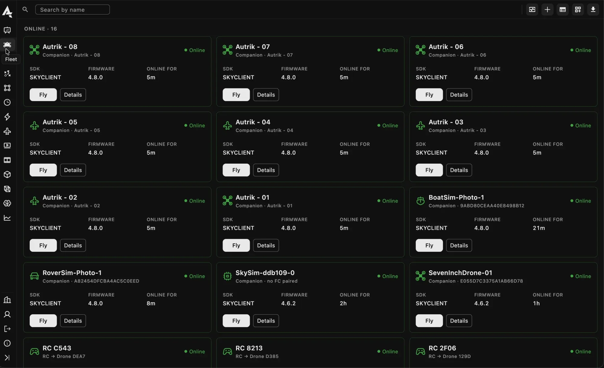
A mixed fleet in one list: aircraft, a boat, a rover, remote controllers and simulators.
Aerial operations
Classic drone work, and the domain most operations start in.
- Missions: inspection, mapping, drone-first-response and persistent monitoring, wherever fast coverage from above is the advantage. Survey grids, corridors along a line, orbits around a tower, a facade pass, a panorama from one point.
- Sensors: RGB, thermal and mapping cameras, lidar and stabilised gimbals, with the camera controlled from the browser: zoom, gimbal, lens, capture, the thermal palette.
- Vehicles: multirotor, VTOL and fixed-wing platforms, docked or hand-launched, DJI or built on an open autopilot. The dock is what turns a flight into a schedule.
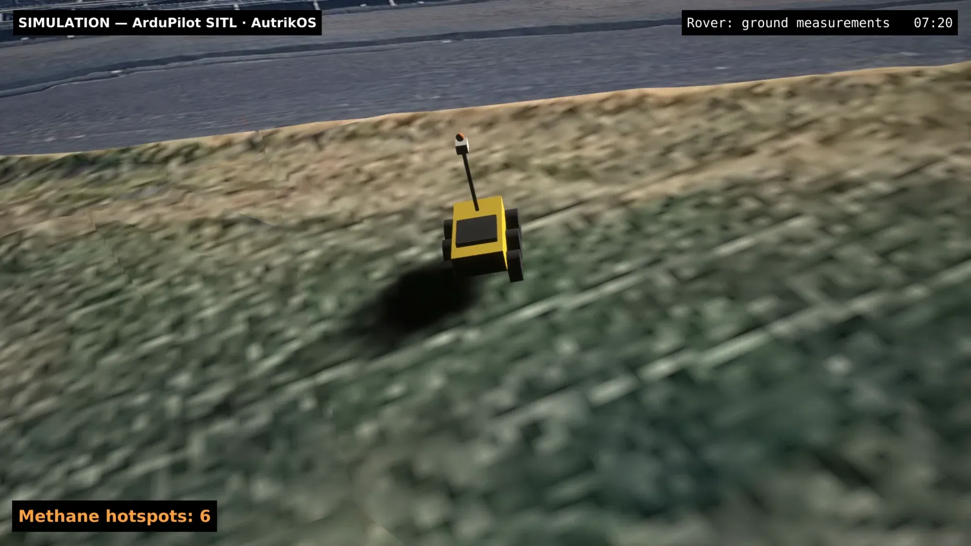
A rover taking ground measurements on the landfill twin, with the methane hotspots it found.
Ground operations
Where the answer needs a closer look than an aircraft can give.
- Missions: close-up analysis, a better angle on infrastructure, long patrols, and operating under vegetation or a roof where aerial coverage fails.
- Vehicles: wheeled and tracked rovers on the same open autopilots as the aircraft, and legged robots where stairs and rubble are in the way.
- Control: a rover is not a slow aircraft. Its steering and speed controllers are tuned from the console with live graphs of how closely it follows its targets, and the tuning records go into its log like a flight’s.
- Endurance: a ground vehicle can stay on task for hours, which changes what missions are worth attempting.
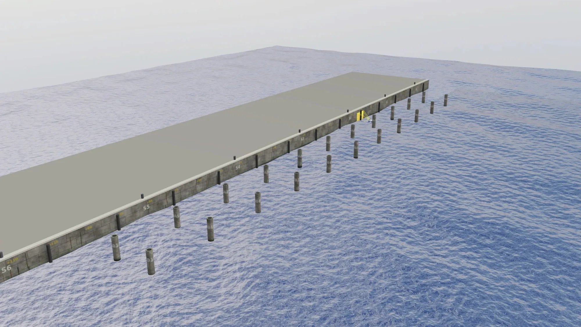
The surface vessel’s quay survey in Gazebo: piles, lanes and the vessel’s track.
Surface operations
Harbours, waterways and water quality, with their own hard problems.
- Missions: harbour and quay inspection, bathymetric survey, water-quality sampling, and support for combined maritime operations.
- Sensors: sonar with a live swath and depth trace, water-quality probes and surface cameras, with the data in the same operational picture as the aircraft’s.
- Harsh conditions: water is not slow air. The vessel is pushed the whole time, you cannot walk up to it, and pollutants, biofouling and corrosion act on the sensors continuously. Remote diagnostics stop being optional.
What the platform has to do the same for all three
- One fleet. An aircraft, a rover and a boat sit in the same fleet list with the same card: online, firmware, who flew it last, what its health says.
- One plan editor. A survey is a survey whether the lanes are flown or sailed; a waypoint route is a route whether it goes over the fence or along it.
- One onboard client. The same software on the companion computer of each vehicle discovers its sensors, budgets its link and ships one log of everything, so the boat’s sonar and the aircraft’s camera arrive the same way.
- One console. The same map, the same video wall, the same logs, with the controls that differ per vehicle: take-off and return for the aircraft, arm and start for the rover and the boat.
When one domain is not enough
The difficult sites are the ones no single vehicle type covers. Combined operations are where the platform earns its keep.
- Air overview, surface detail. The aircraft finds what deserves attention; the ground or surface vehicle produces the measurement.
- Shared points of interest. A finding marked by one vehicle is immediately actionable by another, with no handover between systems.
- One report. One deliverable covering the whole site, rather than separate documents the client has to reconcile.
Which domains does your work span? Tell us the site and the questions you need answered, and we will map the vehicles to them. The argument for running several is in The Mission Defines the Robot.